

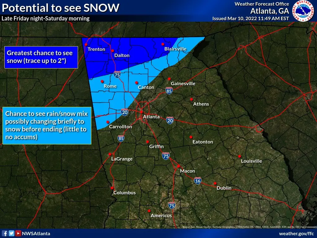
Snow is still in the forecast for parts of north Georgia, but the timing has changed. The snow is now expected during the overnight hours Friday night through early Saturday.
The snow will be preceded by severe weather throughout the state. Isolated thunderstorms are possible across central Georgia Friday through Saturday. A few storms could become strong to severe Friday afternoon into early Saturday, capable of producing strong, gusty winds and a brief tornado.
According to the National Weather Service, wintry precipitation is possible over portions of north Georgia Friday night through early Saturday as lingering moisture combines with cold temperatures. There is potential for light snow accumulations across far north Georgia, with little to no accumulations expected farther south.
Strong gusty winds winds are possible Friday night. Sustained winds from 20 to 25 mph gusting to 30 to 35 mph at times are anticipated.
Winds could be higher across ridgetops in mountainous terrain.
Will see the snow across north Georgia ending after daybreak Saturday with gusty winds continuing through Saturday evening.
Very cold temperatures will move in across north and central Georgia Saturday night with Sunday morning lows in the teens and 20s. Another round of showers and isolated thunderstorms are expected Tuesday and Wednesday.
- Georgia gas prices keep falling, but drivers are still paying nearly $1 more than last year
- What is Georgia’s favorite Halloween Candy?
- Driver seriously hurt after wrong-way crash on I-75 express ramp in Cobb County
- What the botched execution of Christa Pike reveals about Southern Healthcare
- How to Prove Negligence in a Georgia Personal Injury Claim