Scattered thunderstorms are expected to roll through a large part of Georgia today, and some of them could get strong enough to cause real damage.
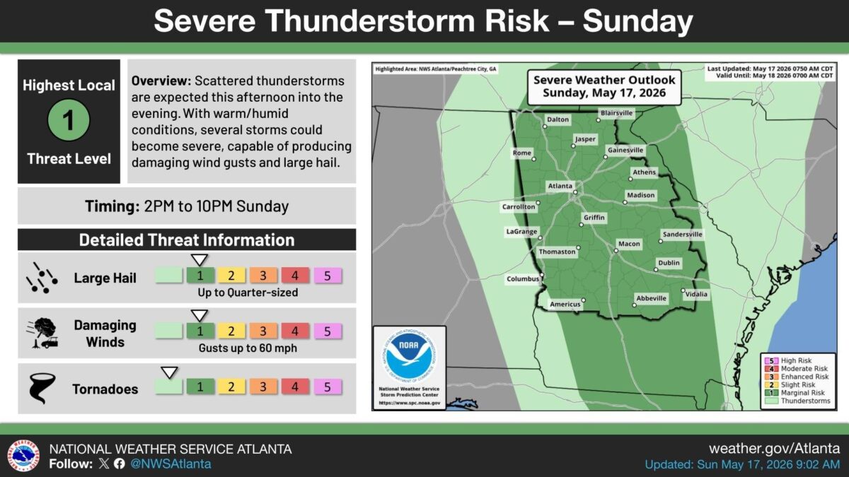
What’s happening: The National Weather Service in Atlanta says storms could fire up between 2 p.m. and 10 p.m. Sunday. Warm, humid air could push some of those storms to severe levels. The overall threat is rated a 1 out of 5 — the lowest level on the severe weather scale — but that does not mean the storms will be harmless.
The threats: Forecasters say the strongest storms could bring:
- Wind gusts up to 60 mph
- Hail up to the size of a quarter
- A low-level tornado threat
Where this applies: The warning area covers a wide stretch of central and north Georgia, including Atlanta, Athens, Rome, Gainesville, Macon, Columbus, Carrollton, Griffin, LaGrange, Thomaston, Americus, Abbeville, Dublin, Sandersville, Vidalia, Madison, Dalton, Blairsville, and Jasper.
How this affects real people: Anyone with outdoor plans this afternoon or evening should keep an eye on the sky and be ready to head inside quickly if storms move in.
The path forward: The outlook runs through Monday at 7 a.m. The National Weather Service will update the forecast as the day goes on.

B.T. Clark is an award-winning journalist and the Publisher of The Georgia Sun. He has 25 years of experience in journalism and served as Managing Editor of Neighbor Newspapers in metro Atlanta for 15 years and Digital Director at Times-Journal Inc. for 8 years. His work has appeared in several newspapers throughout the state including Neighbor Newspapers, The Cherokee Tribune and The Marietta Daily Journal. He is a Georgia native and a fifth-generation Georgian.
- B.T. Clark

- B.T. Clark

- B.T. Clark

- B.T. Clark