

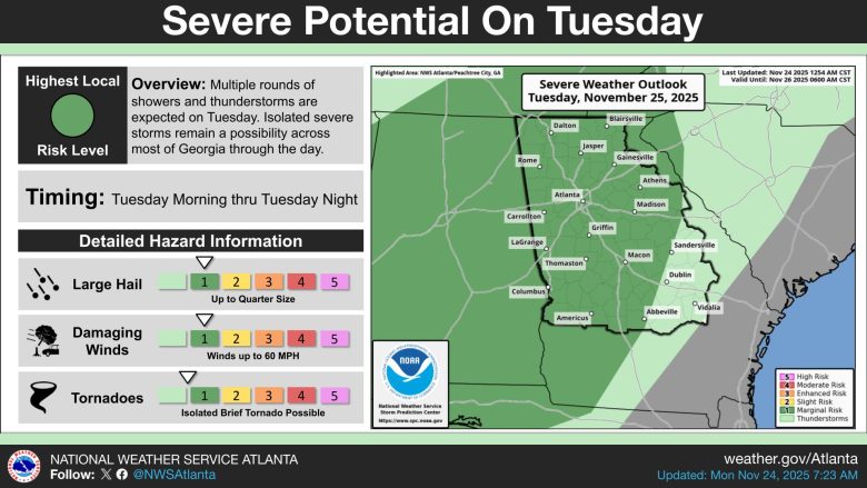
Most of Georgia faces the threat of severe thunderstorms Tuesday, with damaging winds and hail expected throughout the day.
What’s Happening: The National Weather Service has issued a marginal risk for severe weather across much of the state. Multiple rounds of showers and thunderstorms are expected from Tuesday morning through Tuesday night, creating dangerous conditions for residents across Georgia.
What’s Important: The main threats include damaging winds up to 60 mph and hail up to quarter size. Isolated brief tornadoes are also possible throughout the day, though the tornado threat remains low.
Between the Lines: A marginal risk is level 1 on a 5-level scale used by forecasters. While this is the lowest severe weather risk category, storms can still cause damage and create dangerous conditions for anyone caught outside or on the roads.
The Big Picture: The severe weather outlook covers major population centers including Atlanta, Athens, Macon, Columbus and surrounding areas. The storms will move through the state in waves, meaning Georgians should stay weather-aware throughout the entire day and have multiple ways to receive weather alerts.
What You Can Do: Residents should secure outdoor furniture and items that could become projectiles in high winds. Stay indoors during storms and avoid windows. Keep a weather radio or phone alerts active to receive warnings. If a tornado warning is issued, move to the lowest floor of your home in an interior room away from windows.
The Sources: National Weather Service.