

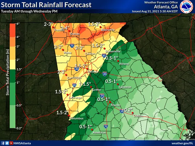
The remains of Ida will move through northeast Georgia as they head into middle Tennessee today.
Periods of heavy rain will be possible this morning into Wednesday. Total amounts are forecast to be highest in north Georgia with 2 to 4 inches and locally higher of 5 or above possible.
A Flash Flood Watch has been issued for parts of north Georgia, that watch now includes the Atlanta metro area. A threat for isolated tornadoes will continue through today into this evening across both north and central Georgia as outer bands move through.
Some strong wind gusts with stronger storms are possible as well. Please stay tuned to the latest forecast for more
information.
Some lingering shower and thunderstorm chances are across the area for Wednesday, though are not expecting any severe.
Otherwise the next chance for any thunderstorms returns to parts of the area for Sunday and Monday.
GET UPDATES ON THIS STORY: Sign up for our free Email newsletter.
- 76-year-old ex-wife charged with murder after two people were found dead in a Georgia home
- Why is there a large police presence at Brantley County churches today?
- Wildfire danger is high across much of Georgia today
- Have you seen these three missing Georgia teens
- Obama is coming to Georgia to rally for Ossoff on Oct. 28