
We’re looking at a potentially turbulent weather pattern for North and Central Georgia over the next week.
Today and Tonight
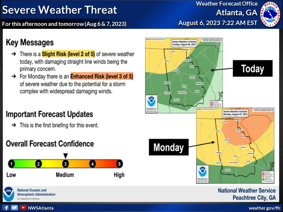
Today, we’re facing a marginal risk, that’s a level 1 out of 5, for severe weather conditions in both northern and central parts of the state.
The morning will see the brunt of the storm activity in the north, with the weather system expected to move into central Georgia by the afternoon and evening. The main concern today is the possibility of isolated damaging straight line winds. Alongside this, we’re anticipating heavy localized rainfall and frequent lightning strikes.
The Week Ahead: Monday through Saturday
As we move into Monday, the weather severity is expected to increase, with an enhanced risk, or level 3 out of 5, of severe weather conditions. The main threat will be damaging straight line winds, particularly in northeast Georgia, although a wide area could be affected between 4 p.m. and midnight.
The northeast Georgia region is still in the process of recovering from around of severe storms that hit in late July.
Adding to the mix, much of Georgia is set to experience potentially hazardous heat on Monday afternoon, with heat indices predicted to soar between 105 to 110 degrees.
Remember to stay hydrated and limit outdoor activities during the hottest part of the day.
The rest of the week will continue to see periods of thunderstorm activity, with the highest likelihood of storms occurring during the afternoon and evening hours each day through to Saturday.
Stay tuned to local weather updates and take necessary precautions to stay safe during this period of unsettled weather.

Thom Chandler
Thom Chandler is the editor of The Georgia Sun and has been writing, editing and managing websites and blogs since 1995. He is a lifelong Georgian and one of those increasingly rare Atlanta natives.
