

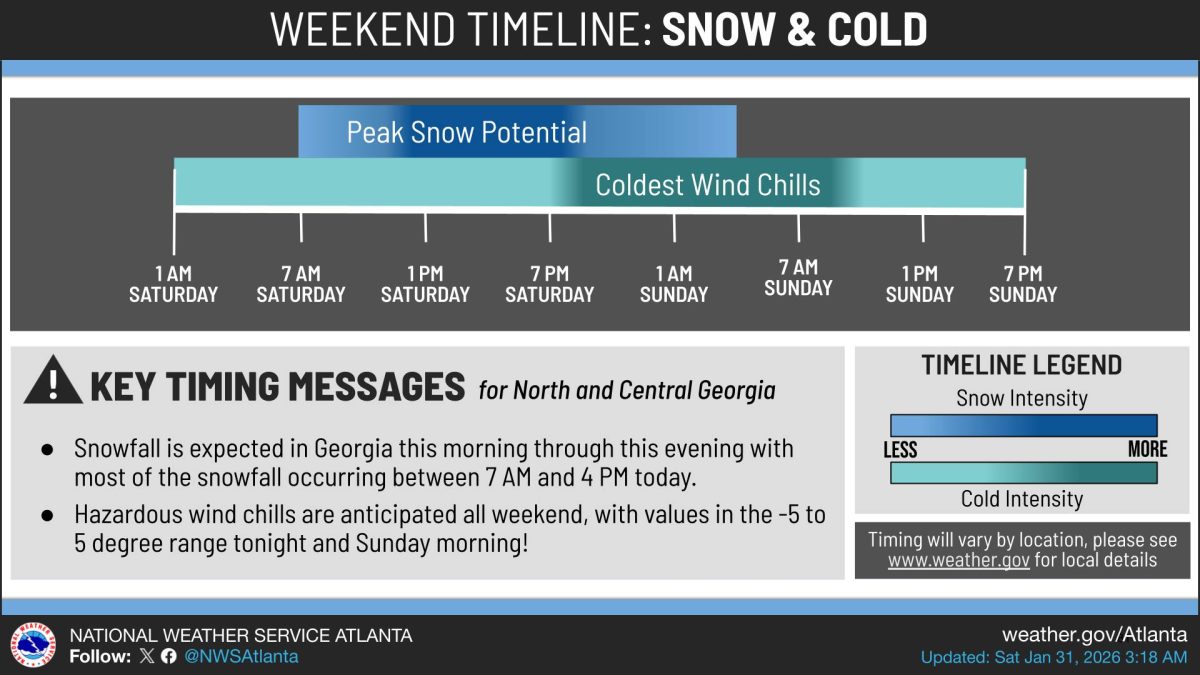
Snow began moving into north Georgia by 5:45 a.m. Saturday and is accumulating quickly, according to the National Weather Service Peachtree City. Snow showers arrived 1-3 hours later than forecast but are still expected through the day.
What’s Important: Most snowfall will occur between 7 a.m. and 4 p.m. Saturday across North and Central Georgia. East-central Georgia is likely to begin seeing snowfall in the mid to late morning before continuing into the evening. North Georgia will continue to see snowfall through the morning and into the mid to late afternoon. Eastern Georgia is still expected to receive heavier accumulations in the 3-6 inch range in bands of snowfall, with 0.5 to 3 inches expected as you go westward.
How This Affects Real People: Wind chills are anticipated in the -5 to 5 degree range Saturday night and Sunday morning.
What Happens Next: The National Weather Service expects snow to fill in more through the morning with accumulations expected. The coldest wind chills are expected from Saturday evening through Sunday morning.
- One dead after tire blowout triggers I-285 crash in Cobb County
- Georgia's tax cut bill comes due… and the most vulnerable will pay it
- ernesto@f.menterprise.app
- Pedestrian Accident Claims in Lawrenceville: Liability, Evidence, and Compensation
- Kennesaw State closes campuses through Sunday as ice storm approaches