

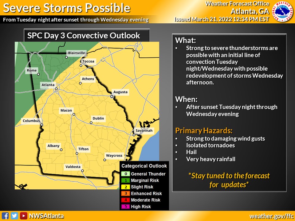
Strong thunderstorms with the possibility of tornadoes will move through Georgia after sunset Tuesday and into Wednesday morning.
According to the National Weather Service, isolated strong to severe storms are possible over west central Georgia late tonight and after 3 a.m. Wednesday morning, as the strongest part of a line of thunderstorms moves in from central Alabama.
These storms could produce damaging winds, hail, very heavy rain and an isolated tornado.
Strong to severe thunderstorms with damaging winds, hail, heavy rain, and brief, isolated tornadoes, will continue to be possible Wednesday, mainly along and south of I-85.
Larger creeks and rivers may rise to near or above flood stage on Wednesday and continue high on Thursday.
- Gwinnett County police involved in shooting in Snellville
- Cherokee County man gets 35 years for sexual battery on overpass near Acworth
- Georgia deer firearms season opens Saturday
- Police identify man killed after being thrown from Goliath coaster at Six Flags
- Gwinnett school administrator named one of Georgia’s 50 Most Influential Latinos