
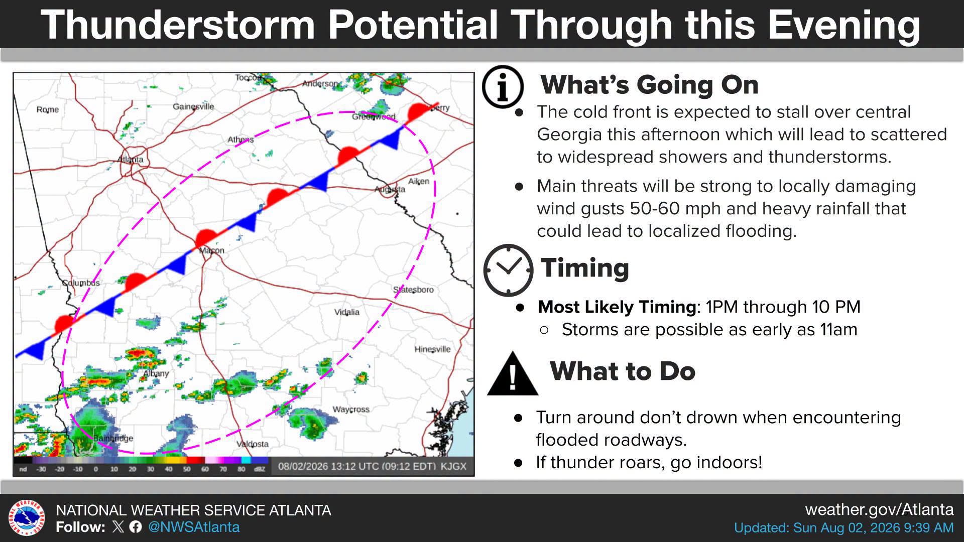

A stalled cold front is setting up a rough Sunday for a large part of Georgia, with strong thunderstorms, wind gusts up to 60 mph, and flooding possible through tonight.
What’s happening: The National Weather Service says the front will park itself over central Georgia this afternoon, triggering showers and thunderstorms that could spread widely across the region. The biggest concerns are damaging wind gusts between 50 and 60 mph and heavy rain that could flood roads and low spots.
Timing: Storms could fire up as early as 11 a.m., but the most active stretch is expected between 1 p.m. and 10 p.m.
What this means for you: Turn around if you come across a flooded road. Go inside the moment you hear thunder.

B.T. Clark is the Publisher of The Georgia Sun and author of Principles Are Like Pants… You Ought to Have Some. Over two decades in journalism, he has served as Managing Editor of Neighbor Newspapers in metro Atlanta and Digital Director at Times-Journal Inc., earning multiple awards along the way. His work has appeared in newspapers across the state, including The Cherokee Tribune and The Marietta Daily Journal.
- B.T. Clark

- B.T. Clark

- B.T. Clark

- B.T. Clark

- South Houston Lake Road – The Georgia Sun
- One dead after tire blowout triggers I-285 crash in Cobb County
- Augusta wing joint fails health inspection with 98 degree walk-in cooler
- Richmond Hill police have a found woman's ring. Is it yours?
- Did Al Sharpton's presence at the Ahmaud Arbery trial intimidate jurors?