
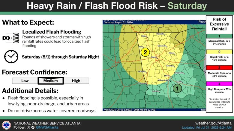
Two rounds of storms are headed for Georgia on Saturday, and residents in the western and northwestern parts of the state face the biggest risks, including damaging winds, heavy rain, and flash flooding.
What’s happening: The first round of storms is expected to arrive late morning or early afternoon. A second round may build later in the day in Alabama before pushing east into Georgia. The main window for severe weather runs from 1 p.m. to 10 p.m.
Where the risk is highest: The greatest threat falls across northwestern and western Georgia, including areas around Rome, Carrollton, LaGrange, and Atlanta. That zone carries a Level 2 (Slight) severe weather risk. Most of the rest of Georgia in the outlook sits at Level 1 (Marginal), the lowest category.
The threats: Wind gusts up to 60 mph are the main concern. Hail up to quarter-sized, frequent lightning, and very heavy rain are also possible. A tornado is not ruled out, though that risk sits at the lowest level on the scale.
Flooding: Flash flooding is a separate danger. Storms are expected to drop rain very quickly, putting low-lying areas, spots with poor drainage, and urban neighborhoods at the greatest risk of flooding. The National Weather Service says not to drive across any road covered by water.
The path forward: The forecast runs through Sunday, August 2 at 7 a.m. Forecasters put their confidence in the flash flood outlook at medium, meaning conditions could still shift. Residents should keep an eye on updates through Saturday night.