

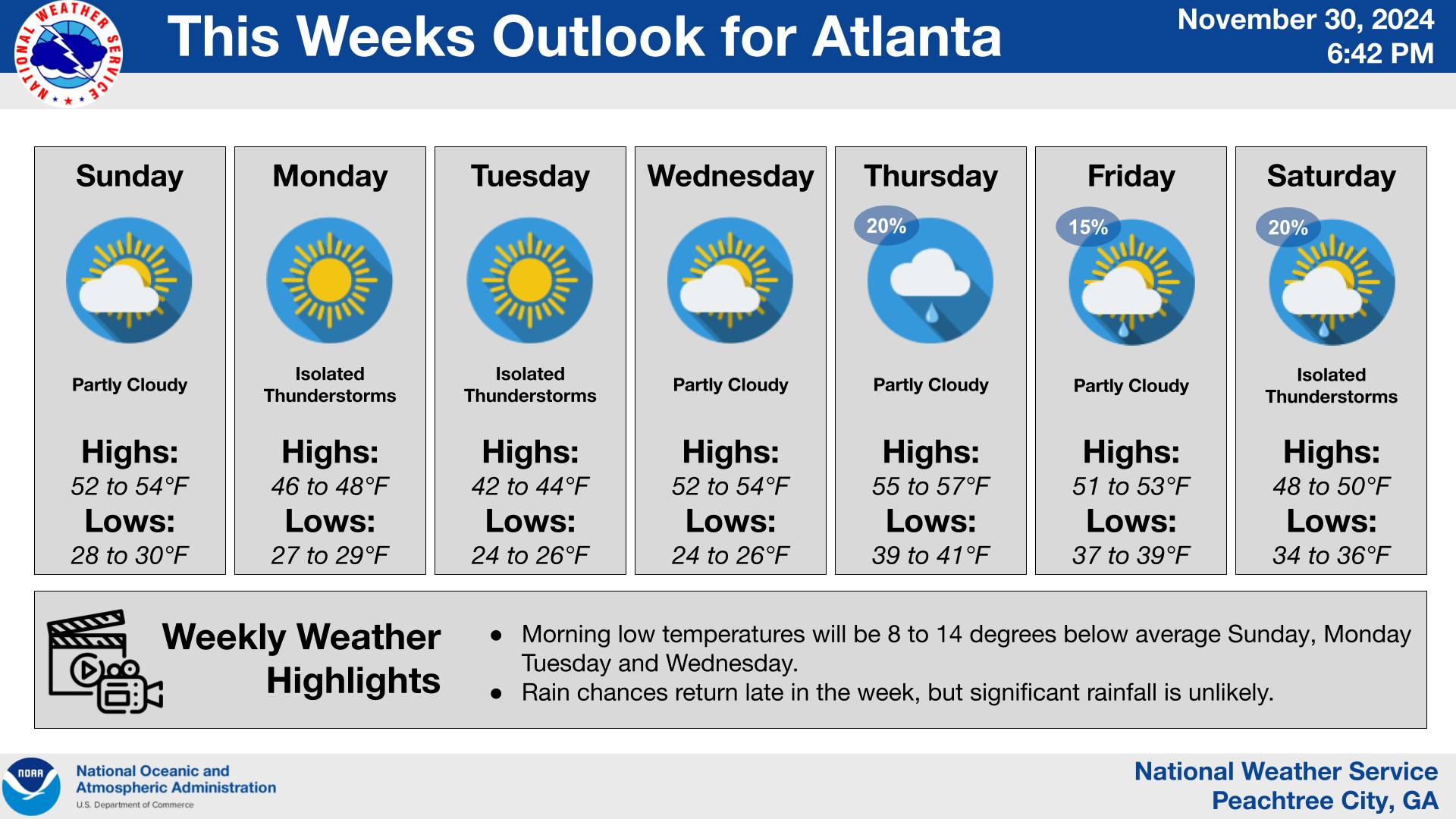
Georgia has been in the grip of an Arctic blast since Thanksgiving, and the trend of below-average temperatures will persist into next week. Morning lows on Sunday are expected to be 8 to 14 degrees below normal, extending a streak of brisk mornings and frosty conditions that have defined the start of the holiday season.
Why It Matters: The extended cold snap has already impacted daily routines and could continue to strain heating systems, increase utility costs, and pose challenges for vulnerable populations. Farmers are also keeping a close eye on the extended frost, which could affect winter crops and livestock.
Why This Should Catch Your Attention: The duration of this Arctic blast raises questions about whether these conditions are an early sign of a prolonged cold winter. For a state accustomed to relatively mild Decembers, this pattern stands out.
What’s Next: The current forecast suggests a gradual moderation by midweek, though nighttime lows will likely remain chilly. Residents are encouraged to stay prepared:
• Continue to protect exposed pipes and outdoor plants.
• Check heating systems for efficiency and safety.
• Stay updated on local forecasts for any sudden changes.
With temperatures staying consistently low for nearly two weeks, it’s a reminder to embrace winter layers and look out for those in the community who might need extra support.