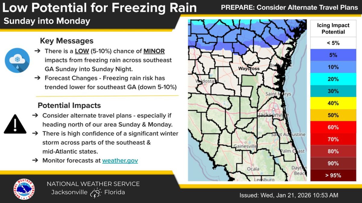
The National Weather Service in Jacksonville issued a forecast Wednesday showing a 5% to 10% chance of minor freezing rain impacts across southeast Georgia from Sunday into Sunday night.
What’s Happening: The forecast shows low potential for freezing rain north of U.S. Highway 84 in southeast Georgia. The chance of freezing rain in the region has decreased by 5% to 10% from earlier forecasts.
What’s Important: Higher chances for winter storm impacts are currently forecast north of southeast Georgia, affecting parts of the southeast and mid-Atlantic states. The forecast remains uncertain and details are expected to become clearer over the next few days.
How This Affects Real People: Travelers heading north from southeast Georgia on Sunday and Monday should consider alternate travel plans. Freezing rain can create hazardous road conditions by coating surfaces with ice.
The Path Forward: As the forecast becomes clearer in coming days, residents should prepare for more certain cold weather impacts. Hard freezes are expected for inland southeast Georgia Monday and Tuesday nights, with freezes forecast for coastal southeast Georgia and inland northeast Florida as arctic air moves into the region. These freezes could damage unprotected plants and pipes.
What freezing rain is: Freezing rain occurs when rain falls through cold air near the ground and freezes on contact with surfaces, creating a coating of ice on roads, bridges, trees, and power lines.