
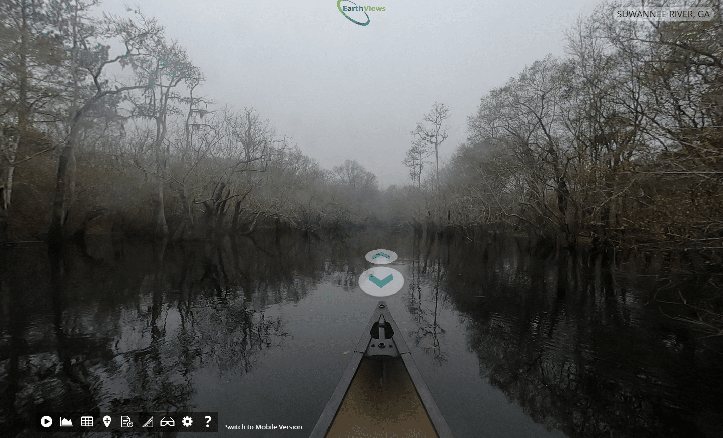
Georgia’s rivers are getting a better map. Georgia River Network is partnering with EarthViews to create modern, 360-degree digital maps of Georgia rivers. Similar to the “Street View” feature on Google Maps, anyone can go online to EarthViews.com and explore an expanding list of Georgia’s rivers ranging from the Tallapoosa in the west to the Ogeechee in the east.
With plans to map hundreds of miles of Georgia Rivers during 2021, Georgia River Network is leading the way in using digital mapping technology to help educate people about these critical waterways, as well as help scientists with research and river management. Founded in 1998, Georgia River Network serves as the voice of Georgia’s rivers and works to empower everyone to enjoy, connect with, and advocate for economically vital and clean flowing rivers.
EarthViews introduced the world to better waterway maps in 2016 when they mapped the Elwha River in Washington state forty-eight hours after the largest dam removal project in history. Since then, EarthViews has partnered with NGO’s federal, state and local agencies including the National Park Service and National Geographic to map thousands of miles of rivers around North America and Africa.
EarthViews vision is to use modern mapping technology to connect people to critically important aquatic ecosystems. To accomplish this vision EarthViews developed an application to bring waterways to your desktop, mobile or VR device via easy-to-use, publicly available, interactive maps. These reality-based maps have many uses for waterway conservationists, rivers users and natural resource managers including:
- Locate points of interest.
- Educate with virtual field trips.
- Scope areas for recreation activities.
- Collect data.
- Visualize waterway data in context.
- Digitally preserve the waterway, creating a baseline of current conditions.
- See it before you get there to enhance waterway emergency management and navigation.
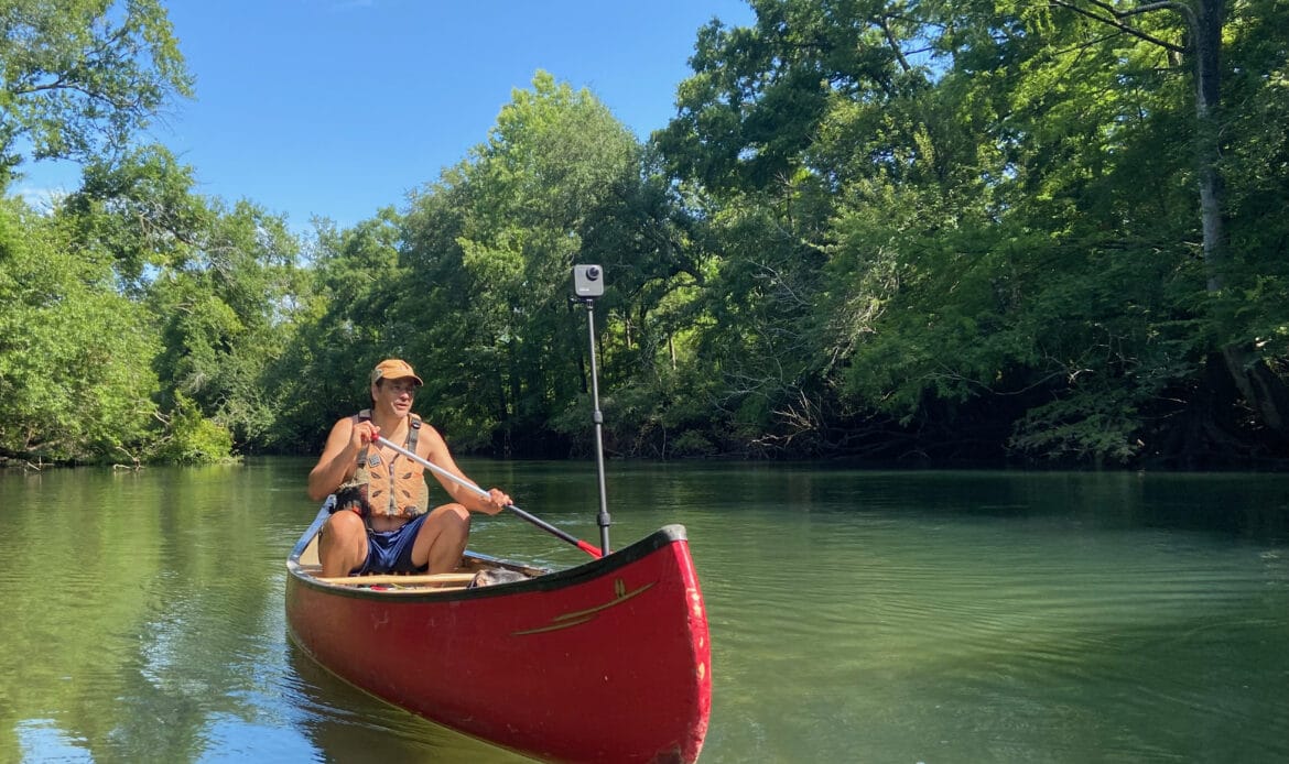
In March when it joined the EarthViews mapping partnership program, Georgia River Network received an easy-to-use mobile mapping kit. Since then, GRN’s Paddle Georgia coordinator, Joe Cook and volunteers have been capturing imagery and data while paddling Georgia’s rivers. The data is then downloaded to EarthViews portal and processed by EarthViews for publication on EarthViews’ growing Map of Waterways.
For Cook, who is working on Georgia River Network’s guidebook series to Georgia rivers in cooperation with the University of Georgia Press, the technology is another way to assure the information provided about rivers is accurate.
“When traveling and documenting rivers, I take notes on paper maps,” Cook said, “Having photographic documentation of every foot of the river supplements these notes. And, for river users, Earthviews maps are the equivalent of “try it before you buy it.” As we document more rivers, it should make our rivers more accessible and safer because you can see what you’re getting into before ever putting your boat in the water.”
Since January, Georgia River Network has documented sections of the St. Marys, Suwannee, Ogeechee, Tallapoosa, Chattahoochee, Flint, Ocmulgee, Ohoopee and Satilla rivers as well as Spring Creek and South Chickamauga Creek. The organization’s goal is to map all of the state’s 19 established water trails.
