

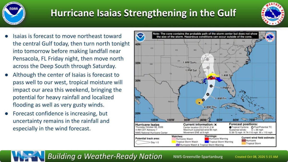
The tropical storm that forecasters warned could drench Georgia this weekend has strengthened into a hurricane overnight, and the threat of flooding, high winds, and tornadoes remains on track for the state.
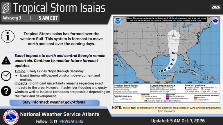
What’s new: Hurricane Isaias reached Category 1 status overnight into Thursday, with maximum sustained winds of 80 mph. The storm had formed Wednesday over the western Gulf of Mexico as a tropical storm.
What’s happening: Isaias is moving northeast across the Gulf and is expected to make landfall near Pensacola, Florida on Friday night before pushing north on Saturday. “Isaias has strengthened to a Cat 1 Hurricane overnight,” the National Weather Service’s Greenville-Spartanburg office said Thursday morning. “Forecast confidence is increasing on the track, but uncertainty remains in the rainfall.”
What this means for you: Georgians could see heavy rain and localized flooding, strong gusts, and isolated tornadoes, most likely Friday night through Saturday. Forecasters say the wind forecast in particular carries significant uncertainty, so conditions could shift.
The path forward: Residents should monitor weather.gov/Atlanta for updates as the storm moves closer to landfall.

B.T. Clark is the Publisher of The Georgia Sun and author of Principles Are Like Pants… You Ought to Have Some. Over two decades in journalism, he has served as Managing Editor of Neighbor Newspapers in metro Atlanta and Digital Director at Times-Journal Inc., earning multiple awards along the way. His work has appeared in newspapers across the state, including The Cherokee Tribune and The Marietta Daily Journal.
- B.T. Clark

- B.T. Clark

- B.T. Clark
- B.T. Clark

- Popular Lawrenceville pizza restaurant flunks health inspection with a score of 57
- Tropical Storm Isaias could bring heavy rain, strong winds to Georgia. Here's when it may arrive
- Crime – The Georgia Sun
- Carroll County will require passes for trash drop-off sites starting in 2027
- 'You didn't even know anyone at that school:’ Apalachee school shooter gets life in prison and no parole