

- Risk of flooding, hail and isolated tornadoes will extend from Texas to Florida and the Carolinas through the weekend
- Freezing rain is possible in parts of the Northeast Friday night and Saturday morning
- The risk of flooding and avalanches is increasing across the Northwest as relentless storms hammer the region
More than 10 million people will be at risk for a four-day stretch of severe weather that is expected to rumble through the South and Southeast United States.
AccuWeather expert meteorologists say holiday travel and outdoor festivities could also be impacted by a storm that is forecast to bring freezing rain and ice to parts of the Northeast into the weekend, as well as a relentless train of storms that is pounding the Northwest.
Severe weather threat from Texas to Florida
Flooding downpours, hail, damaging wind gusts and isolated tornadoes are possible Thursday from Houston, Texas, to Shreveport, Louisiana.
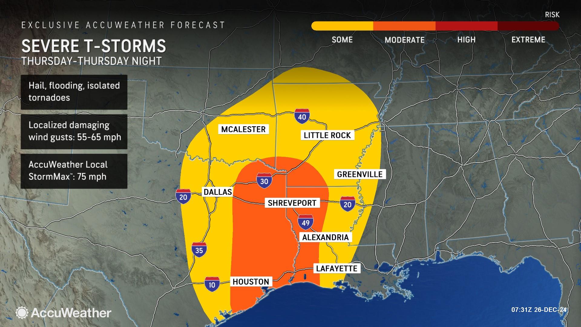
“Given sufficient energy and a pronounced change in wind speed and direction with height in the atmosphere, all modes of severe weather are on the table, including hail, flooding, high winds and isolated tornadoes,” AccuWeather Meteorologist Gwen Fieweger said. “This will be the second round of severe weather to impact eastern Texas so far this week, with the first round having brought hail, localized flooding and even funnel cloud sightings on Tuesday night into early Wednesday morning.”
AccuWeather expert meteorologists say there is a moderate risk of severe thunderstorms in eastern Texas, western Louisiana, southeastern Oklahoma and southwestern Arkansas. Winds can be locally damaging with gusts ranging from 55 to 65 mph. The AccuWeather Local StormMax™ is 75 mph.
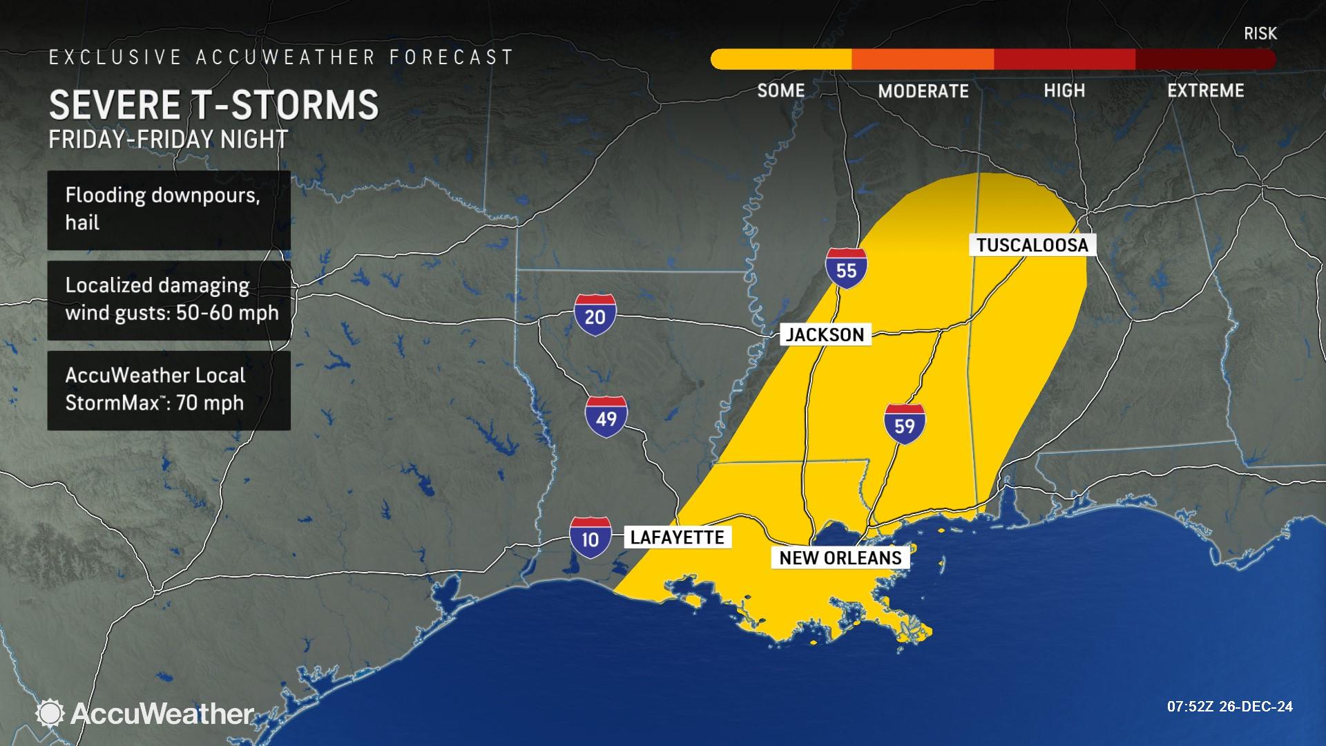
The threat of potent storms will shift eastward Friday from southeastern Louisiana to parts of central Alabama. The primary hazards within storms Friday and Friday night will be flooding downpours, hail and damaging wind gusts of 50-60 mph.
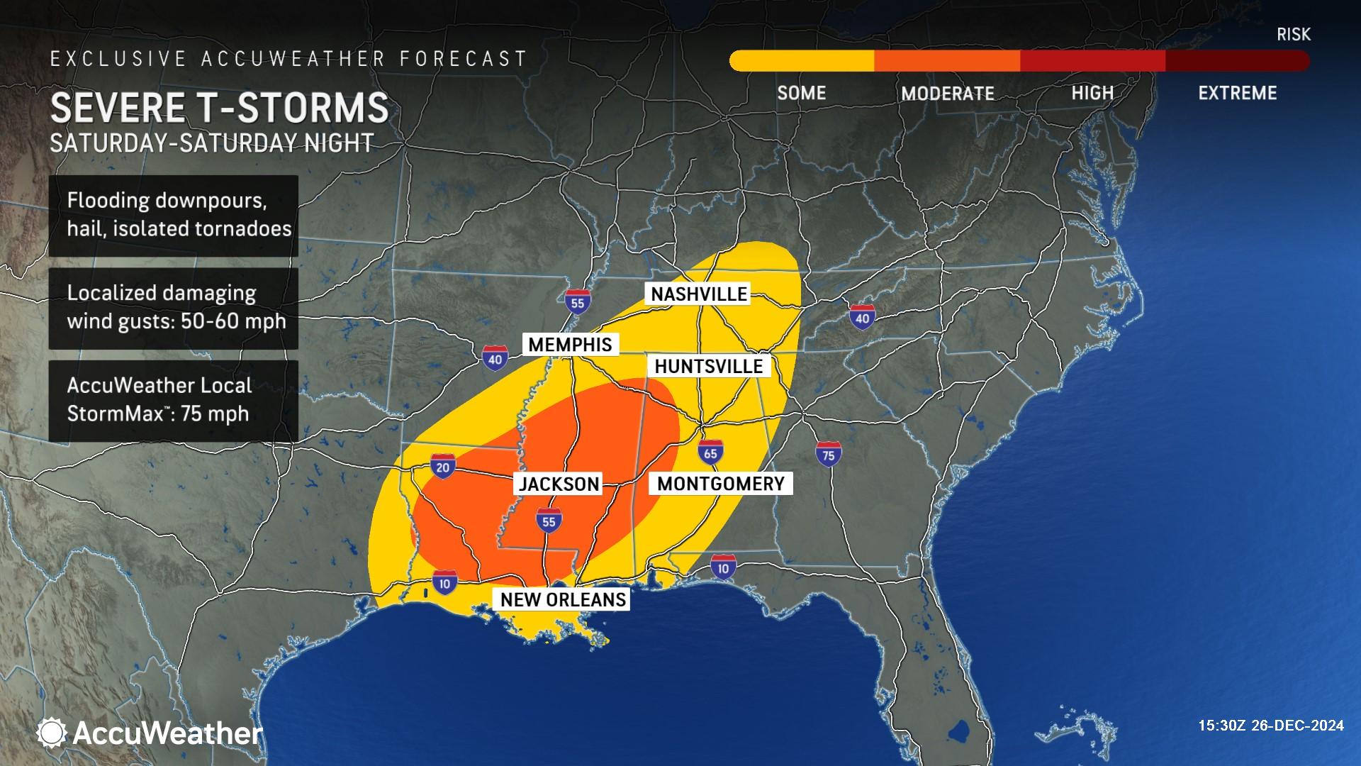
By this weekend, thunderstorms will advance farther across the Southeastern states, reaching places like Memphis and Nashville, Tennessee, and Montgomery, Alabama. The risk of isolated tornadoes will return Saturday.
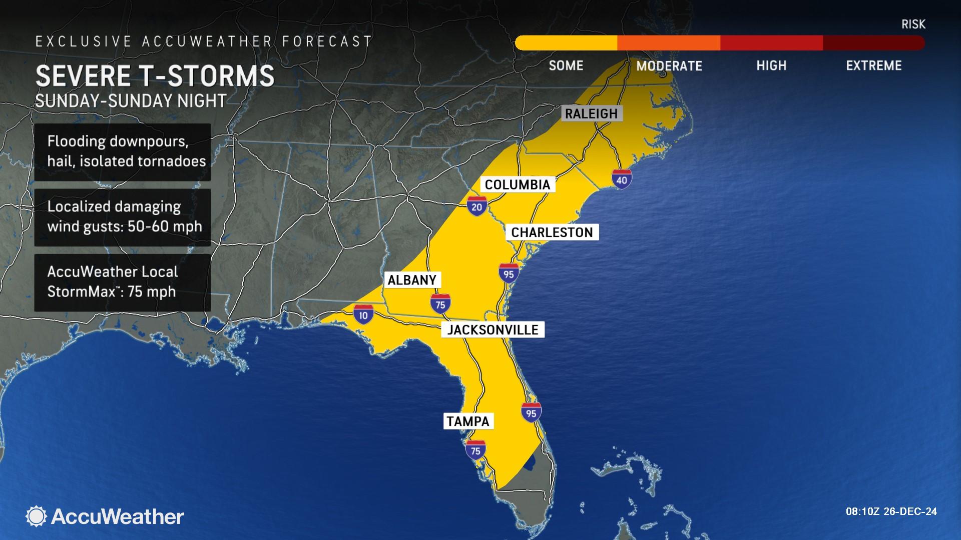
Severe thunderstorms will continue sliding eastward on Sunday, extending from central Florida along the East Coast to eastern North Carolina and southeastern Virginia. Flooding downpours, hail, localized damaging wind gusts of 50-60 mph and isolated tornadoes are possible Sunday. Most of the storms will begin to shift offshore by later Sunday night.
Northeast freezing fog and soaking storm
Patchy freezing fog is possible across parts of central Pennsylvania, upstate New York and the mountains of West Virginia and Maryland Thursday night into Friday morning.
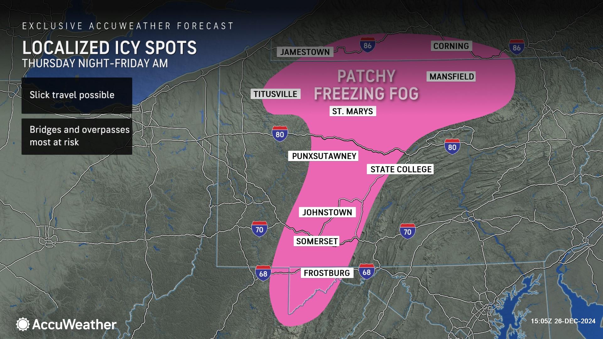
Slick travel conditions are possible in some of the higher elevations.
Travelers in the East will contend with wet weather returning as moisture slowly advances eastward from the middle of the country this weekend.
Mild air building into the region later this week should limit wintry precipitation to upstate New York and New England.
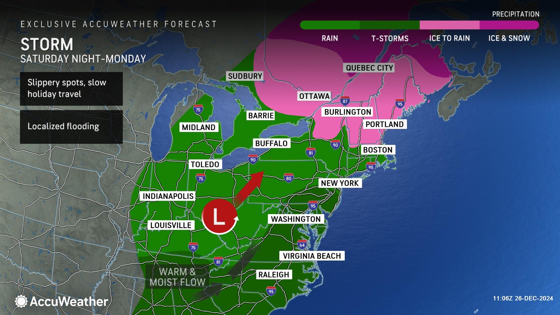
AccuWeather expert meteorologists warn there could be a brief period of freezing rain Friday night into Saturday morning across parts of Pennsylvania, New Jersey, New York, Massachusetts, Connecticut, Vermont and New Hampshire, as well as the mountains of West Virginia and Maryland.
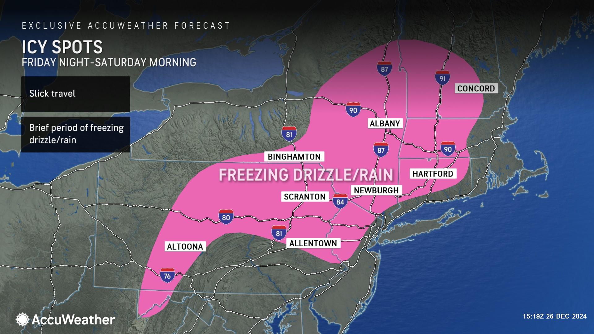
Drivers should be alert for slick spots and icy patches on bridges and overpasses in the region.
The warming trend preventing snow in many places across the Northeast is bringing noticeably milder air to the eastern half of the country.
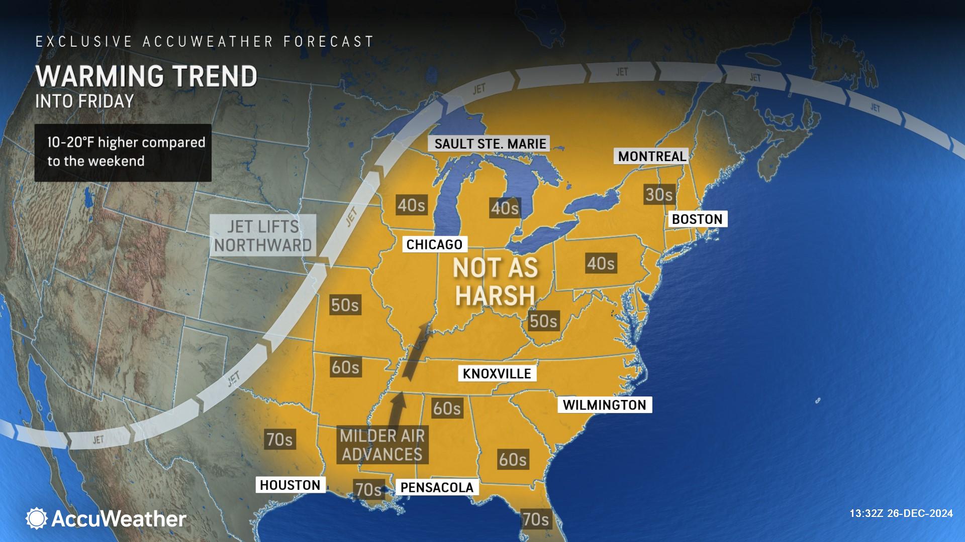
As the jet stream lifts northward and milder air surges in from the Gulf of Mexico, temperatures will climb 10-20 degrees higher compared to last weekend.
Flooding and avalanche risk in the Northwest
The relentless stormy pattern along the West coast is expected to continue through the weekend as additional moisture-packed storms sweep into parts of California, Oregon and Washington.
AccuWeather expert meteorologists warn there will be an enhanced risk for flooding, mudslides and avalanches as holiday travelers begin to return from their destinations.
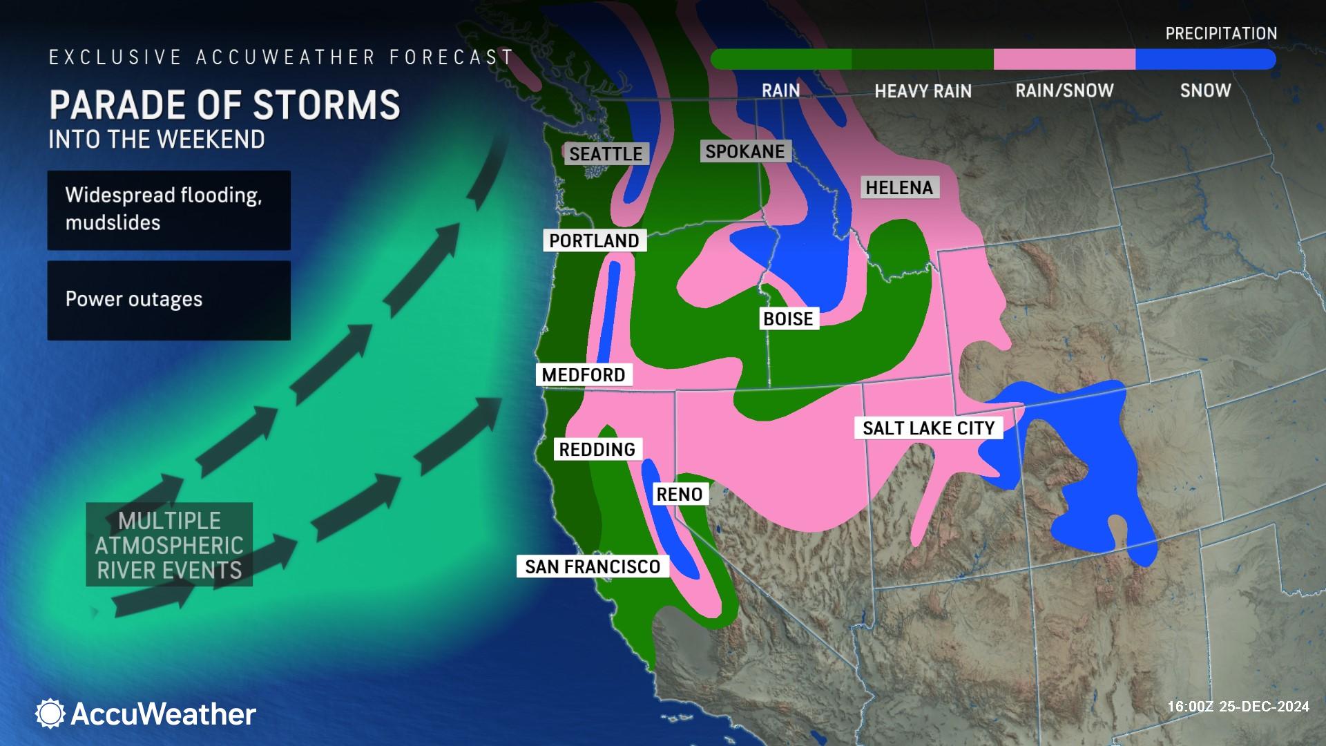
“Some of the most impactful storms of this tumultuous stretch will hit the region during the latter half of the week,” AccuWeather Senior Meteorologist Tyler Roys said. “Since the ground is already soaked from prior storms, any additional rainfall through Friday will increase the threat for flooding and mudslides, especially across burn scar areas and along short-run rivers out of the Cascades.”
The next wave of storms late Friday to Sunday night could bring additional rainfall amounts up to 8 inches across parts of northwestern California and southwestern Oregon. The AccuWeather Local StormMax™ for heavy rainfall late Friday to late Sunday is 18 inches.
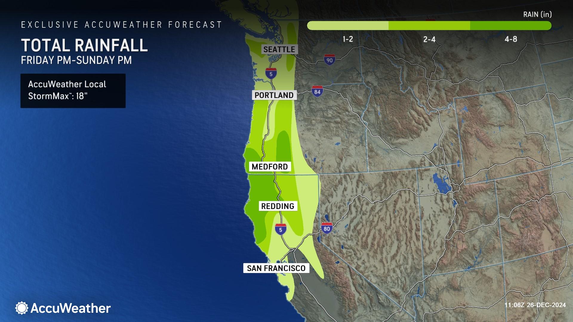
Blizzard conditions are a concern as snow continues to fall across the Oregon Cascades and intense winds pick up. Up to 2 feet of snow is expected through Friday in some mountains across Oregon and Washington. Varying freezing heights, a melting and refreezing pattern and water loading the snowpack will increase the risk of mountain avalanches in the region.
