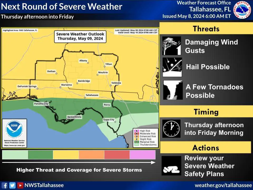
⚠️ The Gist: A strong cold front pushing into the Southeast later this week is expected to bring several rounds of severe thunderstorms, with the potential for damaging winds, large hail, and a few tornadoes from Thursday afternoon into Friday morning.
🤔 Why It Matters: Residents in the affected areas should stay alert and prepared for potentially dangerous weather conditions, as the storms could cause property damage, power outages, and pose risks to public safety.
❓ What’s Happening: The Storm Prediction Center has issued a Slight Risk (level 2 of 5) for severe weather across parts of the Southeast, including southeast Alabama and southwest Georgia.
- The first wave of storms could impact the region as early as Thursday afternoon, with subsequent rounds possible Thursday night into Friday morning.
🔍 Between the Lines: In addition to the severe weather threat, locally heavy rainfall is also possible, which could lead to localized flash flooding.
- The Weather Prediction Center has issued a Marginal Risk (level 1 of 4) for excessive rainfall both Thursday and Friday.
🖼️ The Big Picture: As the cold front moves through the region, it will bring a change in weather conditions. Residents should stay informed about the latest forecasts, warnings, and any emergency instructions from local authorities. It’s essential to have a severe weather plan in place and to know what to do in case of a tornado warning or other severe weather emergencies.
💭 Your Take: How do you prepare for severe weather events like this one? Share your tips and experiences in the comments below, and let’s help each other stay safe during these storms.